Seamless BIM terrain models – better infrastructure projects
In building a new road or railway it is essential to start with a good terrain model of the existing situation to achieve the best possible result. This is crucial to planners, contractors, owners and society. It is all about reducing risk in relation to time, money and quality. Good terrain models and BIM for infrastructure is the way to go.
 Traditionally, the terrain model has not always been a priority. In general consultants have used contours from map files, while the contractor has put together his own model. Unfortunately, this may lead to the terrain being interpreted differently, which in turn compromises the result.
New BIM requirements require change
With increasing requirements for model data from infrastructure owners, and new BIM for infrastructure solutions becoming available the future looks more promising. But this requires the ability to change. BIM needs much better project collaboration, something that requires a clear, accountable and joint terrain model basis.
Scan Survey is a company that specializes in supplying detailed seamless terrain models to infrastructure projects. The 25 years old company experiences a growing business potential through more BIM design and client requirements for complete model deliveries.
Joint terrain models – a must
– If you don´t have a good terrain model as a foundation, there is a risk of negative surprises during the project, claims Jørgen Ravn, co-founder and Chief Technical Officer at Scan Survey.
The company originally started with traditional surveying, but today it is increasingly processing data from external suppliers and existing map databases. They process scanned data from aircrafts and vehicles, in addition to data from the company´s own field surveying.
– Both in the early planning phase and during detailing, the terrain model should be best possible in order to make the right decisions and avoid problems, says Ravn. He praises the Norwegian road and rail authorities to be at the forefront when it comes to requirements for BIM model deliveries.
Unique collaboration using Novapoint
As a consequence of this Ravn in particular points out that all design engineers can now work simultaneously on the same live data model. This has not been possible in infrastructure projects before Vianova recently released its new generation Novapoint with the cloud-based model collaboration solution Quadri.
Jørgen Ravn announces that Scan Survey is ready to deliver seamless, detailed terrain models to Quadri. The company has done development work for a couple of years to adapt to the Novapoint solution.
Pioneers in their field
– Novapoint with Quadri is simply the toolset we have dreamed about for years, advocates Ravn. – The solution is really powerful for 3D visualization and handling large amounts of data. This for example means that once we have processed millions of scanned points, we can instantly see what we've done. We can turn and twist the model and make visual quality control. Typical errors in the model data are quickly detected.
Scan Survey is a pioneer in using Novapoint and has worked with a beta version since 2010.
Better models – better results
– We have not yet managed to “choke” the system due to the volume of data, says Ravn. – We have made a significant development work to deliver TIN models to Novapoint in order that map data can be utilized optimally. First and foremost, by processing and “filtering” information and reducing the amount of data, and at the same time preserving the quality of the terrain model.
The TIN method requires more computation than the grid model, but in return it provides the details you need.
– This may result in 20% more data processing, but the project gets a very good return of this investment, as the TIN model provides a much better basis for design, says the Ravn.
Rich models – "small" data volumes
– Something very interesting with Novapoint is the fact that we are now able to combine the properties inherent in the map databases with the modelling. We can for example get forest areas and other uniform terrain surfaces in the 3D model, including descriptions and values. In addition, we can specify metadata and the quality of data, specified on each surface.
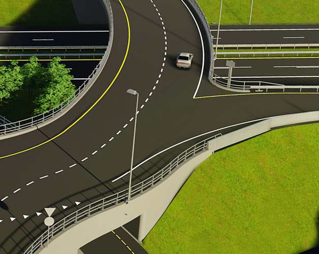
One concrete example of data processing and reduction is a helicopter scan of a 40km long and a 2-3km wide terrain corridor, with a 400m wide detailed construction work zone. From an initial point cloud of half a billion points, the model was converted into 20,000 detailed surfaces. A data volume of 25Gb was reduced to 400MB whilst taking care of the quality of the model.
Seamless and traceable
– Novapoint takes care of all these data, praises Ravn. – The road design engineer can anytime see the details we have put into the terrain model. There is good traceability in the system, with information about standard deviation and point reduction on each surface.
Scan Survey believes terrain modelling from multiple sources is here to stay and will be used to a greater extent going forward.
– Our strength is that we put it all together into a seamless model, says Jørgen Ravn. – The design engineers should not spend time on this. They should focus on planning and designing using the seamless terrain model.
Collaboration in the Cloud
– In addition to visual inspection and high data reduction, we in addition get a lot of object properties included in Novapoint, praises civil engineer Are Jo Næss at Scan Survey. He and colleague Olav Røer Ellefsen have prepared the digital terrain model for the complex Ring 3 Ulvensplitten road project in Oslo and have been using Novapoint Beta there for some time. They are e.g. responsible for all the model data being uploaded to the Cloud and that the built data eventually end up in an "as-built" model.
– It has worked very well, says Næss. – Everyone get the right work permission they need, and always the latest data version to work with. Novapoint provides a very good system around audits and traceability. A big advantage, he says.
Provides competitive advantage
– The model is seamless and dynamic, points out Ravn. – All discipline data are included and always up to date in the model. All disciplines can see what the others do.
Ravn envisions that future infrastructure projects will require even more and better model data when they will realize the benefits of BIM, Novapoint and new model delivery requirements from infrastructure authorities. He therefore believes the demand for their services will only increase in the future.
– The first ones to really implement Novapoint will have a market advantage, he argues. – It will at first “cost” them a little in terms of effort, but the effort will quickly be beneficial. We are already there, concludes Jørgen Ravn at Scan Survey.